Some Really Big Trees…

Today we headed out to visit Sequoia National Park and Kings Canyon National Park. Leaving about 9 am we drove 70 miles south thru Fresno to the entrance to Sequoia National Park.

But before we left we set the crockpot on a timer so that when we came home we’d have a big pot of Tuscan Chicken Spaghetti waiting for us. Then we hit the road, heading toward Fresno, about 30 miles south.

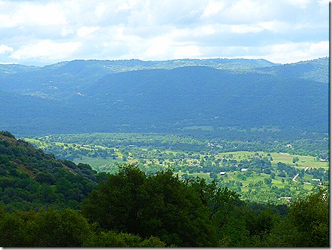
Leaving Fresno, which is at 300 ft elevation, we starting the climb up into the Sierras, with some great views along the way. Click to enlarge the pictures!

SequoiaView


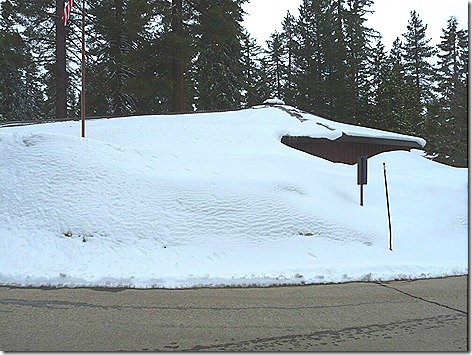
And just like yesterday we ran into snow. We started encountering it about 4500 feet, and it just got deeper the further up we went.

SnowRoad

SnowPile

SnowPile 2


When we got to the Ranger Station at Grants Grove at almost 7000 feet, we really saw the snow in deep drifts.

GrantsGrove


There was a lot more snow here in Sequoia than in Yosemite yesterday.

GrantsGrove2


After checking in at the Ranger Station and checking out the Gift Shop, we had to change our travel plans. We had planned to drive the big 60 mile loop thru the park and come out down south near Visalia. But we found that loop was closed due to the heavy snowfall and would not be open anytime soon. That meant we would not be able to see the General Sherman Tree, the largest tree in the world. Bummer!

But we would be able to see the 2nd largest tree, the General Grant tree, so we headed over to Grant’s Grove a couple of miles away to take a look.

This is the first big tree we saw right in front of our truck when we parked. It’s hard to convey how really big these trees are. The pictures really don’t do them justice.

SequoiaBase


And across the parking lot were these twins.

DoubleSequoias 


And here is the General Grant tree. It’s 267 feet tall and about 35 feet in diameter. It is estimated to be over 1600 years old.

Grant Tree 3  


And here is an internet picture of the General Sherman that we didn’t get to see. It’s about 275 feet tall and about 40 feet in diameter at the base. That’s bigger than our RV !  It’s between 2300 and 2700 years old. The spread of the branches at the top is almost 110 feet wide.

Sherman Tree


After viewing the trees, we went back to the lodge for a really good lunch at the restaurant, much better than the one at Yosemite yesterday.

Then after lunch, we drove out into the forest for about 10 miles just taking in all great scenery along the way.

SnowTree 

SnowRoad 2    

Then it was time to head home. Coming back down thru the mountains, we went thru several cloud layers, but by the time we got down to the bottom, it was clear and sunny again. And going from almost 7000 feet to 300 feet really makes the ears pop.

We got back about 3:30 to a coach filled with wonderful smell of our dinner cooking away.

We ate about 6 pm and it was great. It’s the first time Jan’s fixed this Tuscan Chicken Spaghetti, but we’ll definitely have it again.

Tomorrow is a take-it-easy day. We’re going to get together with some friends, George and Sandy, who we’ve corresponded with for awhile, but didn’t actually meet until the Nick Russell’s GypsyJournal Rally in Yuma this past March. We discovered yesterday that we’re both in the same park here.

Oh WOW !!!!

We left the rig about 9:15 am heading out to see Yosemite National Park. As we got closer to Oakhurst, the 2nd town over, we started to see a lot of snow on the mountains that wasn’t there yesterday.

After stopping for gas in Oakhurst, we headed north about 5 miles and entered the Sierra National Forest, which borders Yosemite. Along the way we encountered more and more snow, which gave us some incredible views. Click to enlarge the pictures.

SnowDrive 2 SnowDrive 1


Another 10 miles later we entered Yosemite National Park at the Ranger Station. Because of the heavy snow last night (between 6 and 12 inches) we were told we that we needed either chains or a 4 wheel drive vehicle with snow tires to enter the Park.  We had the 4 wheel drive, but no snow tires, but lucky for us they didn’t really check, so we got in. As it turned out, the roads were pretty clear and we never needed it.

SnowDrive 4

SnowDrive 3

We did see several snow plows during our drive so I guess they did a good job. But the higher we climbed the more snow we saw. We finally topped out about 6500 feet, with snow covering everything but the road. And the views were spectacular.

SnowDrive 6 

SnowDrive 5

SnowDrive 7


After a lot of hairpin turns we came to the area known as Tunnel View, which of course involves a tunnel.

Tunnel

Coming out of the tunnel there was a large viewing area looking out over the valley, including BridalVeil Fall. Yes, for some reason it’s called Fall, not Falls.

TunnelVista 

As we got closer, the Fall got more and more impressive.

BridalVeilFall


BridalVeilFall2 

We stopped at the Fall viewing area and walked up the 1000 foot trail to the base of the fall. With all the spray in the air, it was almost like it was raining.

BridalVeilFall3

SnowPeak 2

Then it was on to Yosemite Village, which is the turnaround point for the trip, with more great scenery along the way.

SnowPeak 

SnowPeak 3

As we got close to the Village, we saw the other big waterfall in the park, Yosemite Falls. Yes, this one is called Falls, not Fall. Don’t asked me why.

Yosemite Falls 2

Yosemite Falls 3

After buying some souvenirs at the Yosemite Store, we stopped and had a bad lunch at the Lodge. The best part was the cookie we had for dessert.

We also saw a lot of Sequoias in the Park. For some reason I always thought that Sequoias and Redwoods were the same tree, but they’re not. It turns out that Redwoods are only found in northern coastal California up near the Oregon border.

Sequoias 

Coming home, we started seeing first rain, then sleet, and finally, sleet, hail,and snow, all mixed together.

We got home about 3:30 pm, glad to be back where it was warm and dry.

Tomorrow we plan on heading south about 75 miles to Sequoia National Park where we’ll see a lot more, bigger Sequoias.

More tomorrow…


Late Update:

Tonight  on CSI they investigated a murder they thought was done at a shooting range. Although the name was different, the store they used was the one where Jan did her machine gun shooting when we were in Las Vega.

Gun 3

Sitting out the bad weather…

It was supposed to be cold and rainy today so we decided to wait until tomorrow before visiting Yosemite National Park, and although we saw one burst of sunlight, the forecast turned out to be pretty accurate.

So about 12:30 we headed out to get some lunch and some groceries afterwards.

I stopped by the office on the way out to find out how many RV’ers had used the Park discount coupons that were given out at the Yuma GypsyJournal Rally back in March.

As we were leaving the park we saw a squirrel standing sentry on a rock right outside the gate. We tried to get a picture but he spooked before we could get the camera out.

Maybe when we come back.

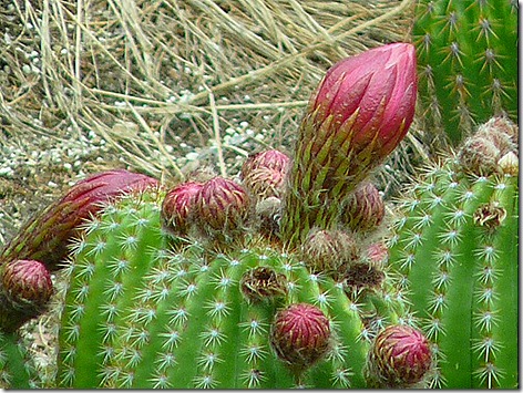
We ended up going back to El Cid because we liked it so much last night. I wanted to have another bowl of their albondigas, Mexican meatball soup. We had some last night as an appetizer to our combo platters, but it was so good I decided to have just a bowl of it for lunch. And we got some more cactus pictures while we were there.

CactusBlooms


We also saw a pair of woodpeckers that, at first glance, I thought were red-headed woodpeckers. But after looking closer at the pictures, I realized they were something I hadn’t seen before. It turns out they are Acorn Woodpeckers.

Acorn Woodpecker

Acorn Woodpecker2

Heading back home we stopped off at Von’s to pick up some groceries.

Coming back into the park, we found our squirrel standing guard on his rock again.

GraySquirrel 1

GraySquirrel 2

Although it looks kind of brown in this picture, it’s a Western Gray Squirrel.

Tomorrow we’re going to drive up into Yosemite National Park. If we make the entire loop, it will be about a 200 mile trip.

More later…

High in the Sierras…

We decided to go out for breakfast about 9 am while we were waiting to see if our new site was open yet. Noting that the site was on the way out, we drove by to check it out and found that it was already empty. But there was a problem.

Although it was a pull-thru, the site was kind of short and rolled off down the hill in the front. By the time I had pulled far enough into the site to setup I’d be tilted downhill too much to get leveled. I thought I’d talk with the Park office when we got back.

On recommendation of the office we had breakfast at Pete’s Place in Oakhurst and it was really pretty good. The bacon was especially good.

We got back to the park about 10:30 and I stopped off at the office to find out if another site was available. One of their people took me out to look over two other sites and I picked 511.

About 11:30 we moved into our new site and got set up.

Click to Enlarge !


This is a really nice area of the park, off the main road so it’s nice and quiet.

Click to Enlarge !

Click to Enlarge !


But because of all the nice trees it took a while to get a sight line on the satellite, I had to move it three times before I got a signal. Here’s how I ended up finding a hole in the trees.

Click to Enlarge !


If I had a roof-mounted sat dish, we’d have been out of luck. As it is, I had to set up the dish about 30 feet behind the coach.

The weather had been overcast and drizzling on and off all day, and it seemed like the perfect time for an afternoon nap.

And it was.

About 4:45 pm we drove into Oakhurst to have dinner at El Cid, a Mexican restaurant that advertised in the park brochure. And it was well worth the trip. The chips were hot, the salsa was cold, the iced tea was good, and the food was great!

And the view wasn’t too shabby either. We sat out on the glassed-in patio that overlooks the High Sierras,

Click to Enlarge !


and looks down on a cactus garden with numerous bird feeders. And tulips, too.

Click to Enlarge !

Click to Enlarge !


Jan was happy to see all the finches since she used to feed them in Houston before we went fulltime. She was surprised to find out that the finches stay here all year, even during the winter with snow on the ground. In Houston they only stay around for a couple of months in the fall.

Click to Enlarge !


We saw several of these red headed birds too, but no one knew what they were. A little Googling told me that these are male house finches. We had never seen them before.Click to Enlarge !

Click to Enlarge !


Even bluebirds were hanging around. Don’t know how happy they were, tho.

Click to Enlarge !


We got back to the rig about 6 pm and settled in for the night.

The weather is supposed to be even worse tomorrow, so we’ll probably wait until Thursday before we do any sightseeing, but we’ll see.

More tomorrow…

Park of the Sierras…

We left the Antelope Valley Fairgrounds about 9:30 am heading for the Park of the Sierras Escapees RV Park right outside Coarsegold, CA.

Our first leg was about 35 miles west on SR138 to hit I-5. That part of the trip went fine. Although the road was two lane, it was smooth and straight with no stoplights or stop signs, with just a few hills right before it joined I-5. And we were treated to more poppy fields along the way.

TripPoppies

But it was a whole different story when we got on I-5 N. We immediately ran into a 5 mile long 6% downgrade. Normally that’s not a problem, but the road surface was awful. It was like driving thru a minefield and we had stuff falling everywhere.

In fact my laser printer was feeling so upset that it decided to “end it all” by leaping off the table to the floor below. In hindsight, it had been feeling depressed lately. The prognosis is unsure at this point.

But once we got to the bottom of the hill it was smooth sailing. And we had some more great scenery, including hillsides covered in purple flowers.

TripSage

We stayed on I-5 until about 30 miles out of Bakersfield, when we got on SR99 heading toward Fresno.

99 turned out to be a really good road, four lane all the way to Fresno. Along the way we started seeing signs for Apple Annie’s Restaurant in Tulare, and thought we would check it out.  And we were in luck, as they had a large enough parking lot to accommodate us.

The food was good and we were on our way in about 45 minutes.

Unfortunately, it would have been better if we had been on our way in 35 minutes.

Coming into Fresno we split off onto SR41. SR41 is a good two lane road that got a little more hilly as we went along, but no real problems.

Until we got to the park.

We pulled in behind a 5th wheeler.and went in. And discovered that I been lied to.

I called the park earlier this week to see if they had an open site for us. They told me they had plenty of room and that I could make a reservation, but really didn’t need to.

And I believed them.

And then I found out that the 5th wheel in front of us had gotten the last site. They had had a lot of RV’s show up and there were was ‘no room at the inn” for us. If we had only spent 10 minutes less at lunch. Ah well.

They said they would have a site for us tomorrow and we could boondock in their dry camping area until then.

So here we are.

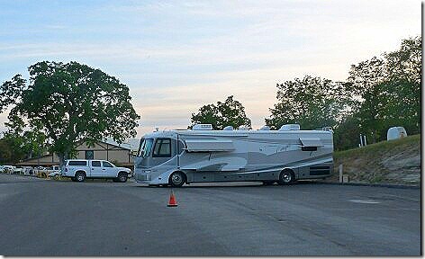
SierraBoondock


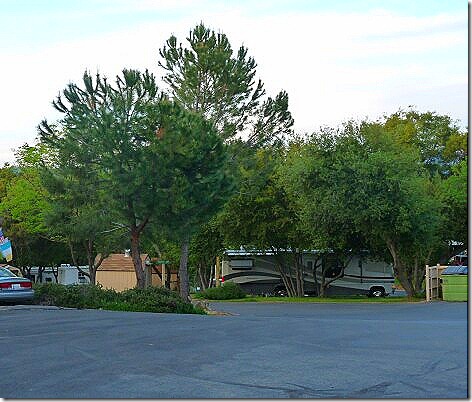
The park is really nice, with hills and trees, something we have not seen since February in Texas. Everything since then have basically been parking lots.

Here’s our most recent site in Lancaster..

AVRVPark 1


And here’s our site in Las Vegas.

RoadrunnerRV


And here’s our site in Laughlin.

LaughlinCasinoRVParking


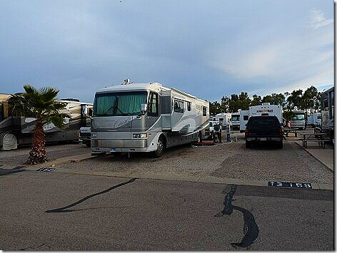
And here’s our site in Tucson.

Voyager1

So hills and trees are nice…as long as they don’t block the satellite dish, of course.

Anyway, here’s some pictures of here.

Sierra 1

Sierra 2

Sierra 3

Not sure what we’re doing tomorrow yet. It depends on how early we can get into our full hookup site.

More later…

Rested up and Ready to Travel…

Tomorrow morning we’ll head north about 230 miles to the Park of the Sierras Escapees RV park in Coarsegold, CA.

But today was a “get ready” day.

After going the Marie Callenders restaurant in Lancaster for lunch, we stopped off for gas and then went by WalMart for supplies.

Back home, I fixed a loose panel on the coach, checked the engine oil, added antifreeze, added water to the coach batteries and checked the tire pressures. And it looks like we’re ready to go tomorrow.

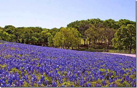
Last week I showed ya’ll some great poppy pictures. Now I want to give equal time to some great Texas bluebonnet pics.

Bluebonnet01 Bluebonnet02


The red flowers are Indian Paintbrushes, another Texas favorite. Bluebonnet03 Bluebonnet04 Bluebonnet05 Bluebonnet06 Bluebonnet07 Bluebonnet08

Take that, poppies!

More tomorrow from Park of the Sierras, at the edge of Yosemite National Park.

Pacific Coast Highway…

Today was our Pacific Coast Highway road trip.

Two years ago this past March we drove the first part of the PCH where it starts at San Juan Capistrano and Dana Point, up thru Newport Beach, Laguna Beach, Huntington Beach, and ending up in Long Beach. I sense a trend here.

We stayed at an RV Park in Long Beach right on the Pacific Ocean. That’s us on the far left.

LongBeachRV 1


And here was our view out the other way. The Queen Mary.

Click to Enlarge !


Anyway, today we drove into LA and got on the PCH near Playa del Rey and headed north.

Click to Enlarge !


Coming thru Venice Beach we encountered this strange sight.  I’m not exactly sure why a CVS pharmacy has a transgendered clown on its marquee, but it is Venice Beach, after all. But this explains it further.

Click to Enlarge !


Coming into Malibu we decided to stop for brunch at Marmalade Cafe right off the PCH. The place was really good, really yuppie, and really expensive. Jan had a short stack of blueberry pancakes with bacon and I had a tortilla scramble. And it was $33!

Leaving the cafe, we headed north again. About 3 miles down the road we came across the Malibu RV Park high on a cliff overlooking the PCH and the Pacific Ocean.

Click to Enlarge !

Click to Enlarge !


What a view!  We may have to think about staying here a few nights when we come back this way next year.

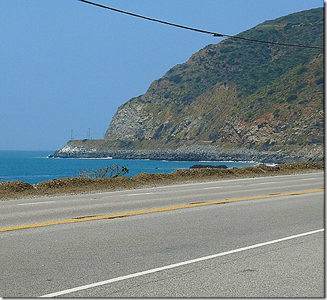
Moving on along the PCH we started encountering some of the really scenic areas.

Click to Enlarge !


This shot I think I’ve seen in a lot of movies and TV shows. It’s Point Mugu.

Click to Enlarge !


Reaching Santa Barbara, we turned around and headed back, this time taking a different, more scenic route. Rather than go all the way back down to LA and back up, we cut across thru the Los Padres National Forest, to Ojai.

This is Lake Casitas, a 420 sq. mile lake that’s over 1000 ft up in the mountains, and it’s really a great view.

Click to Enlarge !


Along the route we passed thru Ojai (pronounced ‘O HIGH”),  I had heard of the Ojai Valley before, and it’s easy to see why. It’s just one big garden. Tree farms, nurseries, fruit orchards with lemons, limes, and strawberries, sod farms, you name it.

Ojai Valley

Leaving Ojai, we passed thru Santa Paula, Fillmore, and on to Santa Clarita on I-5 Then it was a straight shot back to Lancaster and home, a total trip of about 300 miles.

Tomorrow will be a ‘rest up” and “get ready to travel” day, since we plan on leaving here Monday morning,and moving north about 230 miles closer to San Francisco.

More Later.

Esther’s Tacos and Mulholland Dr…

I finally finished redoing the blog entry on our visit to the La Brea Tar Pits so you can check it out here.

————————————————————————————–

Today was a road trip day.

We left the rig about 9 am heading south to Esther’s Taco House in Placentia, CA about 100 miles away.

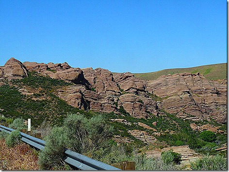
On the way I pulled over to take some shots of the Vasquez Rocks. Although they don’t look real impressive here, when you see them in person they really stand out. You’re driving along thru the high desert mountains, with the hills covered in scraggly scrub brush and small bushes. Click to enlarge the pics.

Click to Enlarge!


Then you take a curve on the freeway and suddenly you encounter these massive rocks thrusting up from the surrounding land.

Click to Enlarge! 

Click to Enlarge! 

Click to Enlarge! 

Click to Enlarge!


It turns out that this is the route of the San Andreas fault line, and these rocks have been pushed up from deep underneath the earth.

Named after an outlaw, Tiburcio Vásquez, who hid out here in the 1870’s and 80’s, the rocks have been featured in countless commercials, movies, and TV shows, including a famous Star Trek episode called “Arena’, where Capt. Kirk is fighting the reptilian Gorn. The rocks in the background here are here at Vasquez.

Click to Enlarge!


This upthrust formation also figures prominently in this show, and  numerous others .

Click to Enlarge!

We got to Esther’s about 11 and sat down to a another great meal. We wanted to eat here one last time before we leave on Monday. And as before, it was really good. They make the best Chile Rellano I have ever eaten. And their enchiladas are delicious too.

Before we left Esther’s I called Park of the Sierras RV Park to be sure they would have a space for us on Monday. They said yes, so we’re good to go.

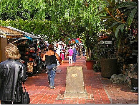
Our next destination was Olvera Street in downtown Los Angeles. It’s the oldest remaining part of the city, and some of the buildings date from the 1870’s.

Olvera 1

Olvera 2

Olvera 3

Olvera 4


Across the street from Olvera Street, we found Los Angeles’ famous Union Station train station. Built in 1939, it is known as the last of the great train stations built in the US.  And, built in the Santa Fe style, it doesn’t really look like a train station. Many movies, commercials, and TV shows have been filmed here.

UnionStation 1

UnionStation 2

Coincidently, Union Station figured prominently in last night’s (4/22/2010) episode of ABC’s “Flashforward”.

Next we headed up I-405 and exited at Mulholland Dr.. We wanted to make the famed drive thru the Santa Monica Mountains to get a bird’s eye view of Los Angeles. And we certainly did. Click to enlarge the pics.

Click to enlarge! 

Click to enlarge!


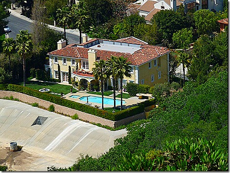
It’s amazing how many homes are built along here, and, considering how many of them seem to be just hanging off the side of the hill, you can see how landsides can damage so many homes.

Click to enlarge!


Seeing how this is California, i was hoping for some nude sunbathing, but no such luck.

Click to enlarge!

Click to enlarge!

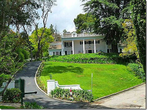
Many stars have homes along here, such as Jack Nicholson, Pamela Anderson, Reece Witherspoon and Paris Hilton.  Unfortunately, we didn’t see any stars, but we really enjoyed the drive.

We got home about 4 pm and settled in for the night.

And tomorrow we’re going to do it all over again. We’re going to drive back into LA to Playa del Rey on the coast, and then head north along the PCH  (Pacific Coast Highway) up to Santa Barbara, before returning home.

Then Sunday, we’ll get ready to travel, before heading out on Monday to the Park of the Sierras RV park north of Fresno..

More Tomorrow…

Shopping Day…

Today was the first day in a while we weren’t on the go, so we slept late and took it easy.

About 10:30 I went over to the office to extend our stay here another 4 days. So now we’ll be leaving on Monday morning. Maybe.

Coming back, I made coffee and we had one of the muffins we brought home from Marie Callenders. Then at 11 am we watched ourselves on The Bonnie Hunt Show while Jan tried to catch up on her journal, but Mister wasn’t much help. He’s never met a horizontal surface he didn’t like.

Mister on Table

About noon we headed out for the lunch buffet at Shakey;s Pizza.

Leaving the RV park, we noticed a LOT of new snow on the mountains just west of here in the Los Padres National Forest.  It was 37 degrees and raining here last night. Looks like it was colder and snowing in the mountains last night.  Here it is almost May and it’s still snowing in California.  Isn’t Global Warming wonderful!  (You can click the picture to enlarge it.)

Click to Enlarge

After stopping for gas, we headed over to Costco. It was only our 2nd time at one since we became members in Tucson. I guess you could say it’s like Sam’s Club, but different.

Next we stopped off at Albertson’s to get some things that Costco didn’t have, or had too much of. I mean, we didn’t need 5 lbs of strawberries. A pound would be fine.

We got home about 3pm, just in time for a nap.

Yesterday, coming back from LA we stopped off at a viewing area along the freeway that looks out over Lake Palmdale and the California Aqueduct. It’s really a nice view.

That’s the Aqueduct in the foreground. (You can click the pictures to enlarge them.)

Click to Enlarge Click to Enlarge

Tomorrow we’re going to drive back into LA, eat lunch at Esther’s Taco House, visit Olvera Street, one of the oldest areas in LA, dating from the 1870’s, and then drive Mulholland Dr. thru the Santa Monica Mountains, above Hollywood and Beverly Hills.

More then…

Homes of the Stars…

We now have a middle name!

Our upcoming grandchild’s full name will be –

Landon Thomas Morrison

We left the rig about 10 am headed for Hollywood and our Movie Star Home Tour.

We got there early enough to have lunch so we decided to try the Hooters across the street from Grauman’s Chinese Theater where our tour would start.

One thing we’ve noticed is the Hooter’s hot wings out west are not near as hot as the Hooters in Texas. We both had ours at “911” which is their hottest normal temp. (Some Hooters also have off the menu temps called “Bentley” and “Elvis” which are hotter still.)  But “911” out here is only about equal to ‘Hot” in Texas.

Anyway we got with our group and were led to our tour bus.

TourBus

Since rain was forecast and it was sprinkling on the way in from Lancaster, we were a little worried, seeing as how we didn’t have a roof. But our tour guide said not to worry, that if it rained, he had a backup plan. Jan asked what the backup plan was, he said “We get wet!”.

Oh boy!

But off we went. And it turned out fine. The rain held off and the sun even came out for a while.

And now, in no particular order, here are some of the homes we saw.


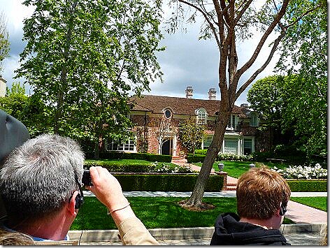
Bob Barker of “The Price is Right” fame

BobBarker


The mountain-top retreat, high above Beverly Hills, has been owned by both Steven Spielberg and Merv Griffin. It’s up for sale now.

Speilberg


This is the entrance to Bill Cosby’s home.

BillCosby


This one is newly-built by Richard and Kathy Hilton, the parents of Paris Hilton.

Hiltons


This home was used both in Will Smith’s “The Fresh Prince of Bel Air” and  in “Mommy Dearest”, with Faye Dunaway.

FreshPrince


This under-construction mansion is rumored to be the new home of Arnold Schwarzeneggar, but it’s supposed to be a tight secret with a lot of security around it, even under construction.

Arnolds


This was Rosemary Clooney’s home.

RosemaryClooney


This is one of the homes used in the Beverly Hillbillies.

BeverlyHillbillies


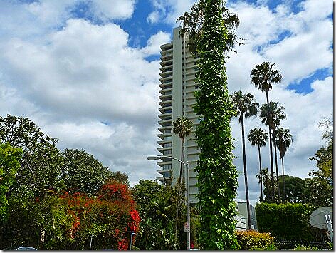
This is the Beverly Hills Tower, home to Elton John, Cher, Sidney Poitier, and Matthew Perry, among others.

BHTower


This is Nancy Reagan’s Nail Salon, where she has her nails done every Thursday.

NancyReagansNailClinic


This is all that remains of the location of “77 Sunset Strip”. It’s the valet parking area, and it’s not located at 77 Sunset Strip, anyway. It’s more like 4800.

77 Sunset Strip


This is the home of “Colombo’s” Peter Faulk.

PeterFaulk


And this is Helen Hunt’s home. And it’s up for sale, if you’re in the market.

HelenHunt


This is the back of Johnny Weissmuller’s home. It has a quarter mile long swimming pool that winds thru the estate, with trees and vines so he could still play Tarzan. His family stills owns it.

Weismuller


This is the front gate of Michael Jackson’s home.where he died.

Michael 2


The balcony here leads into the bedroom where Michael’s body was found.

Michael 1


This was the home of Lucille Ball and Desi Arnez.

Lucy


And right next door was Jack Benny’s home. It’s now owned by Jon Lovitz.

JackBenny


And right next door to that is Carol Burnett’s home. That’s some neighborhood.

CarolBurnet


This is Dr. Phil’s home, also known as the “House that Oprah built”.

DrPhil


This is Tom Cruise’s home, or what you can see of it.


Cruise 


And this home, complete with gargoyles, was the home of Dracula’s,Bela Lugosi.

Bela


This is a shot of the LA skyline, as seen from the Hollywood sign view point.

Skyline 2 


And, of course the Hollywood sign itself. It originally said “Hollywoodland” and was erected in 1923 as an advertisement for the Hollywood Land Co. The last four letters were removed in 1945, or destroyed by a rocket belt-wearing Nazi spy crashing into it in the movie “The Rocketeer”. Take your pick.

Sign 


Back at Grauman’s Chinese Theater, there are always a bunch of movie characters in costumes for people to have their pictures taken with. We’ve seen Spiderman, The Hulk, Batman, Darth Vader, and Princess Leia, just to name a few. However, only in Hollywood would you find KFC’s Colonel Sanders and Jesus, walking and talking.

ColonelAndJesus

Seeing this made me want KFC for dinner, so we stopped and picked some up on our way home.

I wonder it I’ll want to go to church on Sunday, too.

Stopping at KFC, I finally got to try the new Double Down Chicken Chicken Sandwich.

doubledown

It’s two strips of bacon, two slices of Monterey Jack and Pepper Jack cheese, and Colonel’s Sauce, between two chicken breasts. It’s messy to eat, unless you keep it in the wrapper, but it’s delicious.

And at 540 calories, it’s not bad calorie-wise, either. That’s 140 calories less than a Whopper and 160 calories less than a Big Mac.

And did I say it’s really, really good?